
While sailing across the Pacific between 1987 and 1991, I relied on weather bulletins sent by Morse Code.
These were transmitted from Hawaii, New Zealand and Australia – and I received them on a portable shortwave receiver (the only HF radio equipment on our vessel).
 Some of these marine weather broadcasts were transmitted in plain language, but New Zealand and Australia also provided weather data in a series of 5-digit groups that enabled the recipient to draw their own weather map.
(There was a weather facsimile system available, but that was for ships and the occasional yachtie who could afford a weather fax receiver.)
The system transmitted in Morse was known as IAC (International Analysis Code), or “Fleet Code”, and it was an effective, low-budget way to get weather maps.
After receiving each transmissions, my wife Judee would decode the numbers and draw a weather map. She used a simple nautical chart covering the entire Pacific Ocean, folded to show the area we needed, and placed in a very large clear zip-loc bag. Judee would use a set of erasable overhead projector pens to draw the pressure systems and isobars, fronts and troughs on the plastic.
Here’s a sample of Fleet Code I copied:

IAC Fleet Code sample, copied in late 1980s
and here is the decoding guide we had aboard Oceana (click to enlarge):


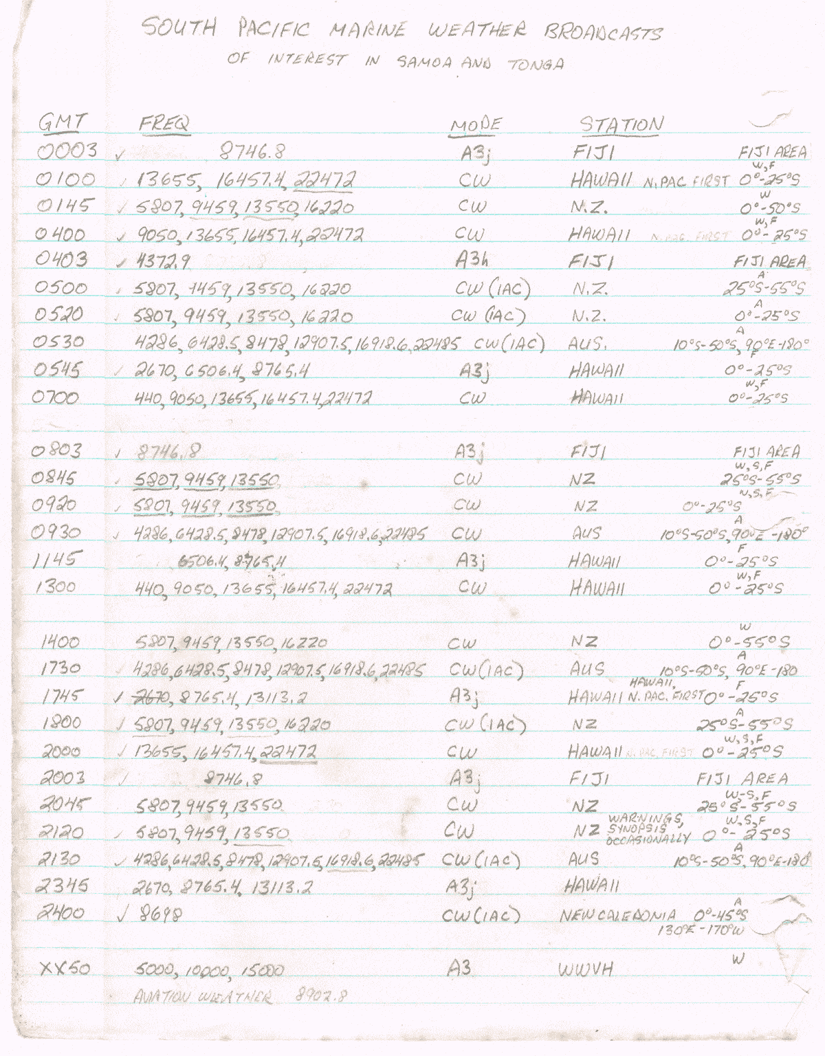
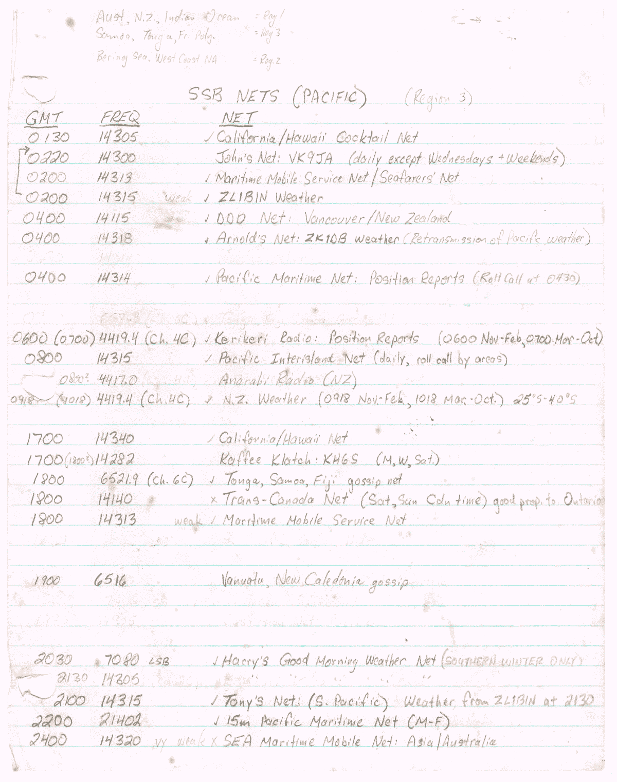
From my radio notebook (entries were in pencil, as times and frequencies could change)
- List of marine weather broadcasts
- List of SSB marine radio nets
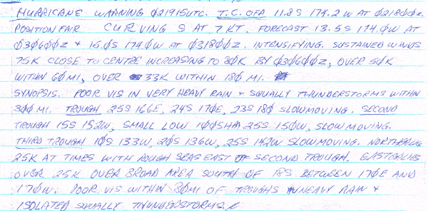
- Sample of plain language Morse weather bulletin
Further reading:
- World Meteorological Organisation #36 Manual on Codes
- International Meteorological Code 1949

